I guess I have legendary skier Cody Townsend and his ‘Fifty’ film project to thank for my recent ski traverse in the Sierra. See, coming into the winter, I had made plans to ski the Bugaboos to Rogers Pass traverse in late April with my good friends and partners, Matt Henry and Trevor Kostanich. But when I watched Cody’s ‘Fifty’ episode of the Bugs to Rogers traverse, I saw Heli-skiing operations, snowmobile tracks, even cabins. It didn’t paint a picture of the pure wilderness experience I was after. This paired with a persistent slab layer in much of Canada, and an incredible snow year in California, got us thinking, and after some discussion, we switched gears and decided to see what we could do in the Sierra with the same window of time. 4/19-4/30 to be exact.
None of us having ever ski toured in the Sierra, it took a bit of head scratching and map reading to decide how much terrain to try to cover. We knew we wanted to stay in the mountains the whole time, as opposed to getting in and out a number of times in pursuit of specific lines. The logical southern conclusion was Mt. Whitney, the highest peak in the range (and the lower 48 for that matter). Eventually we decided that we would enter the mountains at the north fork of Big Pine Creek in order to see the iconic Palisade Crest and Temple Crag. This would set us up with about 80 miles of terrain to cover over 10 days. An amount that we hoped would be ambitious enough to feel like a solid journey, but would also allow for some side trips to ski classic lines.
We had 12 days to work with, and decided we wanted to maximize the schedule for as much mountain time as possible. As such, we did a single-push power drive from Washington to the Sierra on day one, car camped near the trailhead and launched bright and early on the second day of our trip. We’d spend 10 days, 9 nights in the mountains, crash in Bishop on our exit, then power back up to Washington on day 12. Maximized.

Route Outline
From a road closure just below the Sage Flat campground on the Glacier Lodge Road, we departed toward the north fork of Pine Creek, establishing camp on a knoll overlooking Second Lake at just over 10k feet. Our packs were at their heaviest, and our lungs were at their weakest, so even this modest effort tired us significantly, and we settled for just a short acclimatization tour toward the Palisade Glacier before heading back to the camp to try to put a dent in the massive food weight we had brought with us. We saw three skiers from a distance on this day. These would be the last people we would encounter for the next 8 days. Any reports of the Sierra being overcrowded don’t apply to a trip like this one.

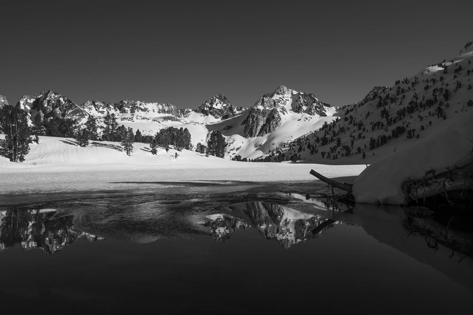
Day 2 was designed for scenic value, and to continue to allow for a slow acclimatization. As such we merely crossed Contact Pass below Temple Crag, and continued over to a beautiful camp on the outlet of Finger Lake. It was in this south Big Pine drainage that we realized just how much spectacular skiing we were going to have to get used to passing by. For every slope we could afford to visit, there were 10 more, equally appealing, but beyond the hours or calories we had to spare. Such is the blessed and cursed life of the traversing skier.
Day 3 was the first legitimate test, as we crossed the crest of the range at Southfork Pass, then bounced up and over a second high col at Mount Bolton Brown before descending to find a glorious patch of dry ground on the shores of an unnamed lake at 11,597’. Here we enjoyed our first proper afternoon of basking in the Sierra sunshine, even taking snow showers and drying like lizards on the rocks until day gave way to the pastel colors of evening, followed by the biting chill of nightfall.

We started day 4 with a steep couloir climb up a north-facing line on the west ridge of Split Mountain, a maneuver we intended to repeat on the west ridge of Cardinal, but were convinced otherwise by some lingering doubts about wind pockets, still somehow being refreshed by hard breezes out of the south. Instead we took our first foray down to the John Muir Trail from Cardinal Lake before climbing back up to and over Pinchot Pass, camping on a bluff above Twin Lakes.
Day 5 began with a gentle cruise below the west side of Mt. Cedric Wright, a gradual ascent past Woods Lake and Stocking Lake before taking aim at a notch in Acrodectes Peak. Turned away from the main saddle by a looming cornice, we opted for an east facing couloir that would still keep us on track. Halfway up, it was apparent that the stubborn wind was continuing to create fresh slabs, and the pillowy, hollow snow in the couloir convinced us to pull the plug and retreat to Woods Lake. Long game. No unnecessary risks. We were burning one of our ‘free skiing’ days, but we found ourselves smitten by the Woods Lake basin and happy for an excuse to soak in the solitude, while letting our minds ski line after line in the surrounding hills.

Day 6 started with the slightly bitter taste of a detour, but soon became an ecstatic alpine rollercoaster ride as we effortlessly ticked mile after mile down the spectacular Woods Creek Basin, while on all sides, wild peaks scratched the morning sky thousands of feet overhead. As our momentum began to slow and the route turned back toward the upper elevations, we began the tree appreciation segment of our journey, first overwhelmed by the massive western juniper and ponderosa pines, then the Seussian shapes of the foxtail and whitebark pines, finally bedding down amongst the limber pine below the monolithic Fin Dome, a perfect white granite feature that looked transplanted directly from Yosemite. Along the way we managed to find an open creek that allowed for a swim in fresh snowmelt and repaired the body and souls as fatigue, sweat and aching muscles washed downstream in a frigid cascade of past tense.

Day 7 would mark a permanent return to the high alpine. It also became the epicenter of where we’d want to return with more time. The steep north facing lines on Dragon and Rexford were from a dream, while the Kearsarge lakes basin was literally surrounded with classic couloirs punctuated with soaring pinnacles of golden alpine granite. Steep climbing would bring us to a massive SW facing run off of University Peak before settling in on a slab of granite near Golden Bear Lake that would pass muster as the floor of a museum. And so we basked.
This was the rhythm of the days. Up before dawn, out of camp with the sunrise, up and over the high-consequence slopes before the full heat of the day, slog the final miles to camp under an oppressive sun. Bask in the sun as its powerful rays refreshed our sweaty or damp gear from the previous night. Dig a hole in the snow or rig a solution on dry ground for the tarp shelter. Dinner with the sunset, then a quick retreat to our shelter and sleeping bags before the shocking temperature drop of night took us by surprise. All the while keeping water, food and laughter flowing freely. Physical, strenuous, joyous, cleansing days.

Day 8 was perhaps the most fully-realized day of high-alpine ski touring. An early start brought us to the spectacular Junction Pass trail in the brilliant light of morning. The route at this point is a gently flowing climb up a broad ridge to over 13,200’ and offers vistas north to the Palisades from which we came and south to Mount Whitney and beyond. So kind was the weather atop the pass that we enjoyed an hour-long second breakfast before setting our sights on a side trip up a beautiful east facing couloir between the two summits of Junction Peak. Freed of the weight of the ‘pigs’ (the name by which we fondly referred to our fully loaded backpacks), we made quick work of the climb, and enjoyed a lovely ski in some of the smoothest snow we’d managed to sniff out. A further dive into the valley presented an impressive scene of alpine walls and some spooky cornices perched perilously a couple thousand feet above. We raced the heat and the overhead hazard to the climb up to Shepherd Pass, then bumped up a bit to establish our highest camp yet at 12,500’, overlooking the Williamson Bowl.

By the end of day 8, we were getting down to the end of our food and fuel supplies, and the need to be precise with our exit strategy was imperative. As such, we reached out for a weather update with the inReach, and learned that a record heat wave was forecast for the final two days of our traverse. Throughout the trip, we had marveled at the amount of snow still clinging to the most unlikely faces and wondering when the other shoe would drop to create conditions that would manifest in a massive shedding event. This warmup was just the kind of thing we were worried about, so our strategy became one of hazard-avoidance.
On day 9 we had two major climbs/descents that we needed to clear before the full heat, so we departed camp in the dark, and watched the break of day from high on the slopes below Trojan Peak, marveling at the towering walls of Mount Tyndall. The coolness of the early morning, paired with fully acclimatized bodies and ever lighter-weight packs resulted in us running far ahead of schedule, and topping Mount Barnard’s east peak hours ahead of plan. It’s fortunate we had time in the bank, because we would spend the next hour walking around on loose scree, trying to find a ribbon of snow that we could use to descend the peak. This was the most emblematic example of a surprising phenomenon we found on this traverse: despite the massive snowpack in the Sierra this spring, the upper elevations (12,500’+) had been so abused by wind, that there was very little snow in the highest part of the range. Our last two camps were our highest, and in both instances we were challenged to find deep enough snow to build our shelter to the specs we’d developed early on. The real wealth in snow-depth was in the 9-11,000’ range. Nonetheless, we managed to piece together a ski descent, and were left with the task of snow-motion walking up to our final camp at 13k on the shores of the frozen Tulainyo lake.

Our original plan for day 10 had been to summit Mt. Whitney before exiting the range via Whitney Portal. None of us had ever been to this part of the range before, and on a map, the Mount Whitney trail down the North Fork of Lone Pine Creek is a terrifying terrain trap constrained in a tight canyon and subject to significant overhead hazard for the better part of the descent. Combined with a record high temperature forecast for the day, we were feeling a bit trepidatious about the safety of our plan. We weighed this against the fact that the Whitney trail is one of the most heavily used routes in the range, and that we couldn’t recall hearing about a lot of avalanche accidents on the route. In the end, we erred on the side of caution and timed our day for optimal skiing from the Russell-Carillon Pass down to Lone Pine Creek, and an exit to Whitney Portal in the cool hours of morning, foregoing the Whitney Summit in exchange for a safe egress from the range.

As we skied past countless mountaineers slogging up and down through deep, isothermic snow and crossing countless fresh piles of avalanche debris on the route, we were very pleased with our plan, and shocked to see the number of people slowly moving through a landscape of immense impending danger. We thanked the universe for our safe passage, and hoped that the endless stream of climbers in the area would be granted the same. Creative skiing brought us to a point somewhat below the Whitney Portal trailhead, leaving us with a surreal 3-mile road walk all the way to the sweltering desert floor at 6,500’, nearly 7k feet below our high point of the morning.

At the winter-closure gate, we were greeted with the most lovely surprise, as the shuttle driver we had hired was parked right at the gate, van tailgate open, cold beers at the ready, his lovely wife effusing enthusiasm for our accomplishment. Turns out that these fine folks, retired, life-long locals of the Owens River Valley, had been keeping tabs on our progress and doing homework on us. We’d become a favorite conversation topic as they decamped each evening on their porch, watching the Range of Light turn from gold, to pink, to blue, before delineating a lower border to one of the most spectacular starscapes on Earth. It felt somehow more special to know that somewhere in the valley below, someone had been thinking of us each night as we burrowed into our sleeping bags, grateful for every gift, large and small that we had been given by these generous mountains.

Gear
There is always a lot of interest in the gear required to pull off a trip like this. I was impressed and pleased that I was able to execute this 10 day outing using a 55L pack which came in under 50 pounds, including food and water. Here’s the breakdown of the kit I carried.

Hard Goods
Black Diamond Glidelite Mohair Mix Skins
Black Crows Duos Freebird pole
Clothing
2 Sets Eddie Bauer Ski Socks
2 Sets OR Echo Boxer Briefs
1 Patagonia Capilene Lightweight Long Underwear
1 OR Argon Short Sleeve T-Shirt
1 Sun Shirt - OR Echo Hoodie
1 Windbreaker - OR Helium Wind Hoodie
1 Hardshell - OR Foray Super Stretch Jacket
1 Down Jacket - OR Helium Down Hoodie
1 Hybrid Pant - OR Skyward Ascentshell Pant
1 Baseball Hat - OR Swift Air Cap
1 Beanie - Black Crows Ora Beanie
1 Lightweight Glove - OR Vigor Sensor Liners

1 Winter Glove - OR Alpinite GoreTex Glove
1 Overmitt- OR Baker II GoreTex Mitts (w/o Liners)e
1 Glacier Glasses - Julbo Shield Reactiv High Mountain
1 Backup Glasses - Julbo Fury Reactiv
Camping
Therm-a-Rest Hyperion 20 Sleeping Bag (This bag is ultralight at 20 oz. and was right at the edge of comfort for this trip. I wore my full clothing kit and slept with a warm water bottle on many nights to stay warm.)
Therm-a-Rest Neo Air XTherm NXT Pad
MSR Reactor 1.7 L Stove (carried by Matt)

16oz bottle of MSR Isobutane Fuel (total fuel allotment for the trip was 4x 16oz. + 1x 8oz.)
Survival
Leatherman Skeleton Multi-tool
Basic First Aid Kit
Basic Repair Kit (tape, zip ties, binding bits, cord, etc.)
Compass
Firestarter Flint
ThinkSport SPF 50 Mineral Sunscreen
Photography
Nikon Z50 (carried by Trevor)
Nikon Z 16-50 DX Lens (carried by Trevor)
2x Nikon EN-EL25 Batteries (carried by Trevor)

I try to start, practice and end every foray into the mountains with gratitude. This trip is no different. Thanks to my ski partners, Trevor Kostanich and Matt Henry for sharing the burdens and the joys, which were made lighter and larger respectively through their presence. Thanks to my family for holding down the fort and giving me an endless well of love to tap into during the lonely hours in the mountains. Thanks to the companies who support my efforts, including MSR, Therm-a-Rest, Black Crows, Outdoor Research and evo. Thanks to Kurt and Sharon for the overwhelming reception and shuttle ride, and to the Hostel California for providing a very soft landing in Bishop where filthy ski mountaineers can shower, strum a guitar and crash amongst people who ‘get it’. And thank you, dear reader, for your interest and your support. Holler with any questions/comments. Till next time!


Leave a comment
This site is protected by hCaptcha and the hCaptcha Privacy Policy and Terms of Service apply.